Utrecht Ring Road Revamp

Title: Same Capacity and So Much Safer.  Top background image: Google Streetview (looking in the direction of travel) of 4 motor vehicle lanes approaching a signal controlled intersection. (Left turn lane, 2 through lanes, right turn lane.) 2 motor vehicle lanes are heading the opposite direction are on the other side of a narrow median.  Bottom background image: Same street that's one lane per direction, with a wide median creating a chicane like curve approaching the intersection. Intersection is kind of like a roundabout. Has a 2 head signal to stop vehicles on the main road if the intersection gets congested.  The linked to PDF contains full text of this image.

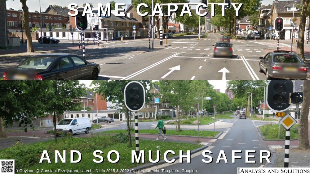
We will be adding more information to this page, but for now, see From Ring Road to City Boulevard and Utrecht's Western City Boulevard: less space for cars, more for greenery and people by Mark Wagenbuur.